August 31, 2026
Build your own running route with the route planner
At runculture.com/route you can draw a running route in a few clicks, or let RunCulture suggest loops that match your distance — with distance markers, running direction, elevation profile, surface information, and GPX download. And attach your route straight to a session in your plan.

Where are you running today? The route planner answers that question in a few clicks. Pick a starting point — search by city or street, grab a saved place like "Home", use your current location, or simply click the map — and decide how your route comes together. On desktop you work in the panel next to the map, on your phone in the sheet below it.
The planner exists because several users asked: can I attach a session from my plan to a route, so I don't have to work out where to run those 12 km7.5 mi every single time? You can: every session in your plan has its own Route button. How that works is explained at the bottom.
Two ways: draw it yourself or generate it
After choosing your starting point you have two options. Draw it yourself: click point by point and the planner snaps the route to paths and streets, with undo and redo when you want a turn back. Or enter a distance, choose loop or out & back, and click generate routes: RunCulture then suggests several loops matching that distance. None of them feel right? One click adds new suggestions. Almost perfect but not quite? Every suggestion can still be edited afterward by dragging its points, and the menu lets you reverse the running direction.
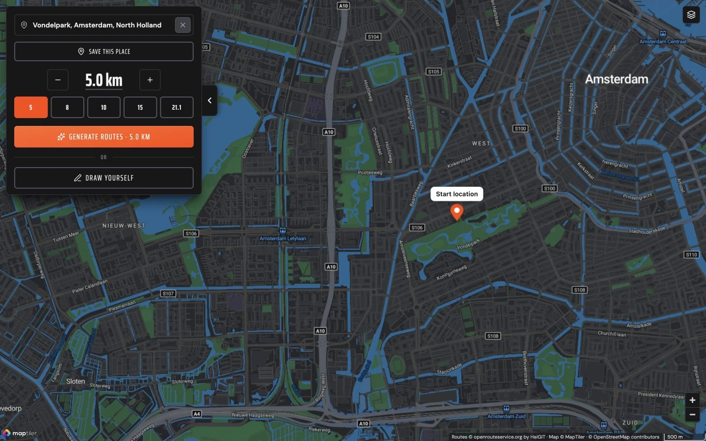
Suggestions that match your distance
Ask for 8 km5 mi and you get 8 km5 mi. The planner learns per neighborhood how routes turn out there and corrects a suggestion that comes out too short or too long, so it stays within a few percent of your target. Come back later for the same distance from the same starting point and you won't see the same route every time, but a different suggestion.
Know what you're in for
Every route gets distance markers on the map and a legend showing where you'll be running: the percentage of path, street, unpaved, and green, the percentage along water, and how many meters of elevation the loop contains. Click elevation for the profile: drag the probe through it and the map shows exactly where that climb is. Want to know which way you're going? Turn on running direction in the layers menu and small arrows appear along the line, also on stretches you run out and back. At the bottom of the panel you'll see the distance and an estimated running time.
Take it with you
Done? Download your route as a GPX file for your watch, or save it — no account needed: the route is linked to your email address and can be claimed to your account later. You open your saved routes in the planner via Saved routes.
Save, share, or keep it private
A saved route gets its own share page with a permanent link, like this loop along the Utrecht canal. Send the link to your running group or drop it in your club chat. On that page you can simply keep editing the route later; the link keeps working. Want to share a route without everyone seeing where you live? Turn on Hide start point when saving: the route stays visible, the exact starting point doesn't.
Attach a route to a session in your plan
Step 1: click Route. At the bottom of every session in your plan there's a Route button; in the session's menu the same option is called Choose route. That session sets the distance the planner works with.
ThursdaySep 10
Easy Run + Strides
Run: 16 min @ 6:35 min / kmRun: 16 min @ 10:36 min / mi
Repeat 6x:
Run: 20 sec @ 4:30 min / kmRun: 20 sec @ 7:15 min / mi
20 sec cool-down
Step 2: pick a saved route or plan a new one. You first get a short choice, with the session shown as a card at the top. If you've already saved a route that fits the distance, it's listed first; below it you choose Plan a new route or another saved route. Pick a saved route and you can view it first or use it right away. Pick new, and the planner opens as a workspace over your plan and immediately generates a suggestion at your session's distance — from there everything works like on the route page: new suggestions, drawing yourself, editing.
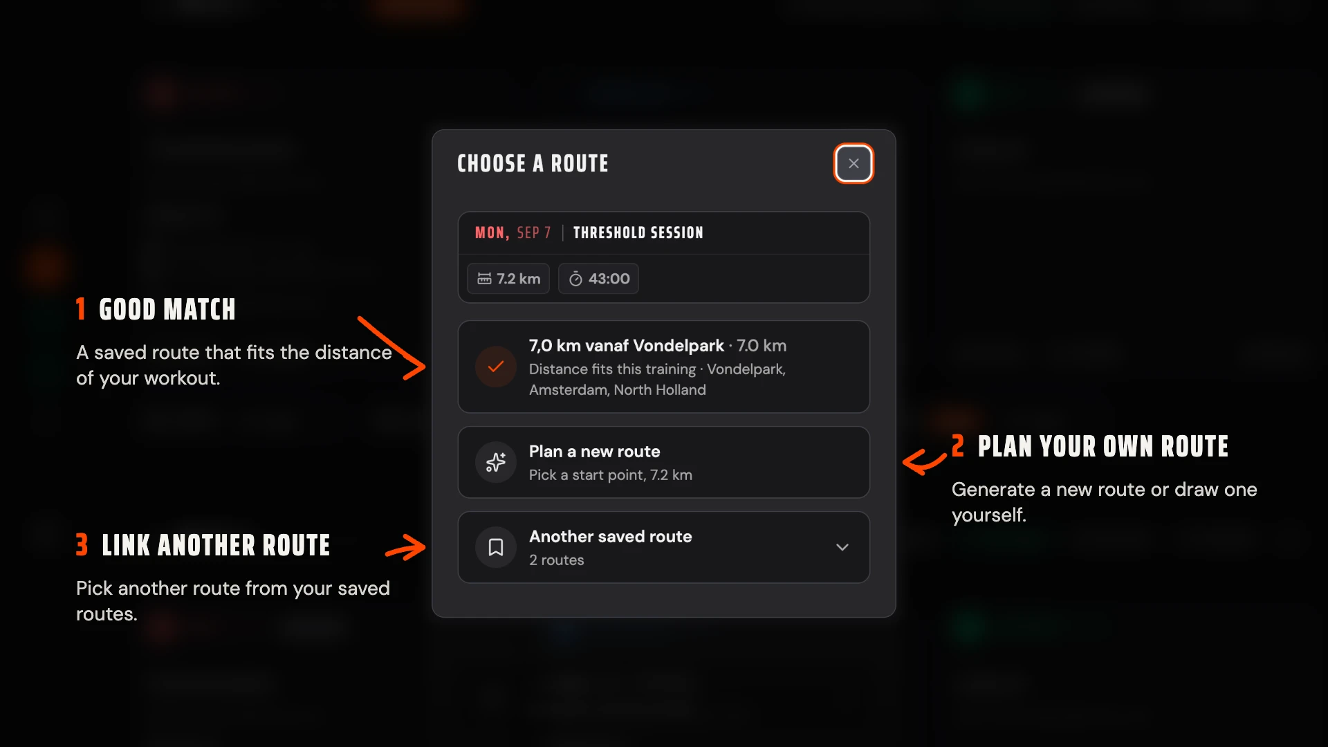
Step 3: use the route. Click Use route. The button on the session turns green. The menu next to it lets you view the route, swap it for another, download the GPX for your watch, share it, or unlink it again.
TuesdaySep 8
Steady Run
8 min @ 6:55 min / km8 min @ 11:08 min / mi
Run: 16 min @ 6:10 min / kmRun: 16 min @ 9:55 min / mi
Click Route to open the route options.
Try it yourself at runculture.com/route, or open a session in your plan.