9 Best Places for a Run in Las Cruces, NM
Whether you are running to keep fit or for fun, you’ll never be lacking for options of running spots in Las Cruces, New Mexico.
But instead of letting you go through the stress of picking a location by yourself, we have compiled 9 of the best places for a run in Las Cruces, NM.
Pine Tree Trail

The Pine Tree Trail is a heavily commuted loop trail in Las Cruces, NM. As the name suggests, this place has a trail surface, and it extends over 4 miles.
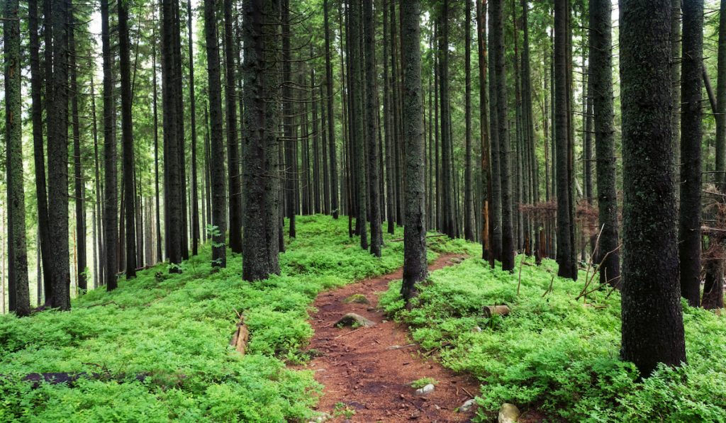
The Pine Tree Trail features rich greenery and multiple wildflowers. Together, these features underline the beauty of this trail.
Besides the vegetation, the Pine Tree Trail offers multiple shaded spots. So, if you ever want to get away from the sun, you can.
The Pine Tree Trail is moderately tough to navigate while running. But you are rewarded with some of the best scenery in New Mexico. If you decide not to run on this trail, you may go hiking, backpacking, or even picnicking.
Ridgeline Trail
The Ridgeline Trail is a point-to-point trail starting from the lower parking lot of the Prehistoric Trackways National Monument and covering a 2-mile distance.
On the Ridgeline Trail, you will find birds and various wildflowers. You will also get a view of Split Rock and the Rio Grande Valley.
The Ridgeline Trail is described as moderately challenging. Its lowest point is around 0.75 miles, and it peaks at 0.87 miles.
Las Cruces Dam Trail

The Las Cruces Dam Trail is mainly used for trail running, walking, and hiking. This out & back route is lightly commuted, and it extends over 6.2 miles.
The Las Cruces Dam Trail is a dirt trail, so you may not see rich greenery around. But it is beside the highway, and you may get to see some cars going to and fro. You will also get scenic views of hills and elevations around the area while you jog/run.
The Las Cruces Dam Trail is a flat path that is easy to run on. But it offers no shade, so it is best used for morning and evening runs.
Ocotillo Loop
The Ocotillo Loop is a short loop trail covering a 0.7-mile distance. In many cases, it serves as a diversionary trail as it adds extra miles to an A Mountain loop.
The Ocotillo Loop breaks off the Tortugas Trail about 0.25 miles next to the latter crosses Observatory Road when you run counterclockwise. Then over 0.3 miles into the loop, it rejoins the Tortugas Trail.
The first part of the Ocotillo Loop is semi-rocky and gently winding. But once you get halfway, you will step into a sandy dirt route.
The sandy-dirt half of the Ocotillo Loop is, for the most part, straight. It also runs through an area with dense Ocotillo vegetation.
The Ocotillo Loop features many desert vegetations, including Ocotillos, in the wet season. You may not see many of those when the heat is up. You may see animals like lizards, jackrabbits, snakes, and roadrunners.
The Ocotillo Loop does not really provide any shade, and it is generally considered a moderately challenging trail to run.
La Maria Trail

As a beginner at trail running, you may fancy the La Maria Trail. It is a 4-mile point-to-point loop trail that intersects the northern part of the Sierra Vista Trail.
The La Maria Trail has a dirt surface, and along the way, you may find a few volleyball-sized rocks. But most of these rocks are sparsely distributed. So, they do not pose any real hindrance.
The La Maria Trail features a couple of wildflowers, but they are sparse. Nonetheless, you may come across different varieties of the Chihuahuan Desert. You may also see some Ocotillos, Barrel cacti, and Spanish Daggers.
Dogs are allowed on the La Maria Trail, but they must be leashed.
Desert Dance
The Desert Dance is a point-to-point that extends over a 2-mile distance. It offers a terrain that is relatively less complicated, so it is a fitting choice for beginners. Although, there are some sandy spots on the way. These spots can be hard to run through.
The Desert Dance crisscrosses in and out of an arroyo, starting from the parking lot to the Lower Figure 8 Trail.
You can run the Desert Dance from any direction. While running, you get a view of hilltops, rocks, and much more. You may also come across sumacs, cacti, agaves, and bushes.
Dogs are allowed off-leash on the Desert Dance. And you may come across animals like birds, snakes, and rabbits.
The arroyo around the Desert Dance sees some water flow during summer monsoons. Interestingly, this flow can change the terrain such that it looks different each time you run on it. The water either washes some sections of the trail or covers them with sand.
Tortugas Trail
The Tortugas Trail is a 5-mile loop trail with moderate difficulty. It is, for the most part, level and features a lot of rocks.
The running spot offers many great views, including a landscape of the surrounding valleys and the Organ Mountains. It is kid-friendly, and you may bring your dogs on a leash.
If you are running on this trail, you should apply sunscreen since there is no shade. Also, if you intend to run after 6 pm, go with a flashlight or some other form of illumination. You may come across hawks, snakes, jackrabbits, roadrunners, and lizards.
During spring and early summer, you should see various desert plants along the Tortugas Trail. But by mid-summer, when the heat becomes more intense, they will have dried up.
Sierra Vista Trail

The Sierra Vista Trail is located around the east and southeast of Las Cruces. It is a point-to-point trail spanning over 30 miles.
Most of the surface of the Sierra Vista Trail is a dirt track with small rocks. But you will find that some of the midsections close to Vado are sandy.
While running on the Sierra Vista Trail, you should come across a cave when you follow the extension that runs south. You may also see some other caves along the mountains around Pena Blanca.
Some of the views along the Sierra Vista Trail include the Wilderness Study Area, tanks of Ft. Bliss, and Northern Pass.
Dogs are allowed on the Sierra Vista Trail, but only if they are leashed. The trail features plants like Ocotillos, the Chihuahuan Desert, and Creosote Bushes. You may come across hawks, lizards, and roadrunners. While they are very uncommon, there have been reports/sightings of coyotes and mountain lions.
It is better to use this trail when there is daylight. Some people use this place for illegal recreational shooting, a possible cover for sinister criminals in the dark.
Baylor Pass Trail
The Baylor Pass Trail is also point-to-point. It spans over 5 miles and starts with a level path. But as you go further, the slope rises, and this makes the climb a bit tough.
Besides the slope, the path is covered with rocks scattered in copiously. So, all in all, this may not be the best option for a beginner.
Along the Baylor Pass Trail, you should come across the Aguirre Spring Campground. It features various types of plants. Some of them include oaks, cacti, pines, and organ mountains evening primrose.
While on the Baylor Pass Trail, you will come across various species of birds. But you may have to pay a fee to use this spot.
Dogs are allowed on the Baylor Pass Trail, but they must be leashed.
Resources
- https://www.alltrails.com/trail/us/new-mexico/pine-tree-trail?u=m
- https://www.hikingproject.com/trail/7048888/ridgeline-trail
- https://www.alltrails.com/trail/us/new-mexico/dam-trail?u=m
- https://www.hikingproject.com/trail/7010454/ocotillo-loop
- https://www.hikingproject.com/trail/7015843/la-maria-trail
- https://www.hikingproject.com/trail/7042133/desert-dance
- https://www.alltrails.com/trail/us/new-mexico/tortugas-mountain-trail–2?u=m
- https://www.hikingproject.com/trail/7010216/tortugas-trail
- https://www.hikingproject.com/trail/7015752/sierra-vista-trail
- https://www.blm.gov/visit/sierra-vista-trail
- https://www.alltrails.com/trail/us/new-mexico/baylor-canyon-pass-trail?u=m&u=m
- https://www.hikingproject.com/trail/7041669/baylor-pass-trail


